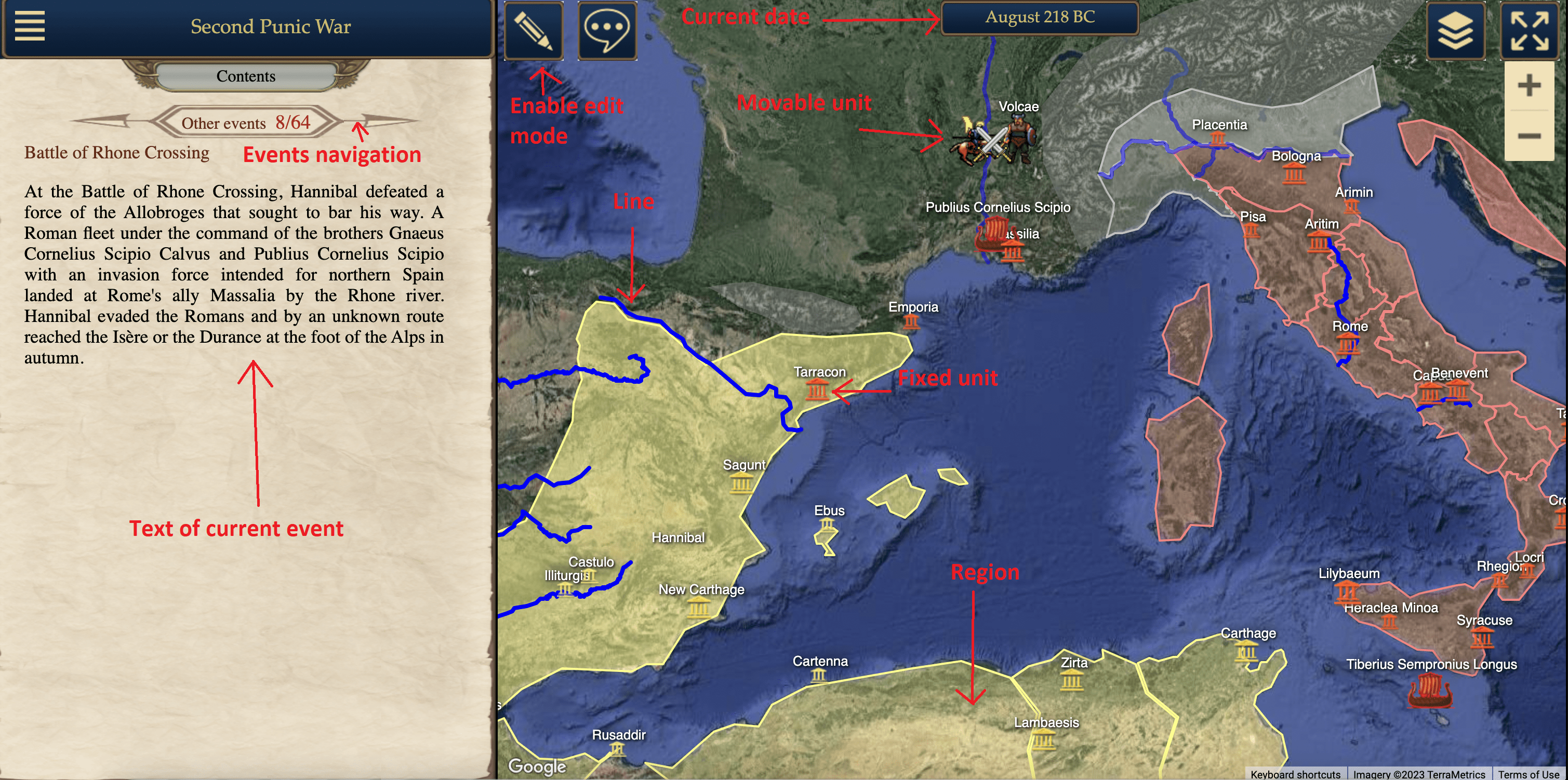
Chronocon is an open-source non-profit editor for historical maps.
The project's goal is to facilitate the study of history through an interactive format.
The project is open-source, and you can find the source code
here.
What is an interactive map?
- An interactive map divides the screen into two parts: the map area and the event area.
-
Each map reflects a specific period in history and has a time step.
For example, Columbus' travel map reflects the time period from 1492 to 1504 with a monthly time step.
The "Ancient History" map, on the other hand, covers the period from 3500 BCE to 500 BCE with a 100-year time step.
Perhaps someday it will be possible to create a larger map that encompasses all of human history.
-
In the map area, objects are located. Depending on the date, objects can appear, disappear, change shape, or change location.
By clicking on an object or hovering the mouse over it, you can access information about it.
Some of the reference information may change depending on the current date, while other parts may remain static.
-
In the left area of the screen, events are displayed.
An event can have a short description, a full description, and a marker on the map.
Each event corresponds to a specific date.
This intentional limitation is in place to avoid overcomplicating the interface.
Events can be organized into chains based on various principles.
For example, they can be organized geographically, such as "History of Germany," or by field,
such as "History of Science" or "History of Religion." Alternatively,
events can be presented from different perspectives, such as "Korean War from the perspective of North Korea" and "Korean War from the perspective of South Korea." Navigation through events is possible both chronologically and within a specific chain.
Why is this format needed?
-
It demonstrates the context of events.
Textbooks and books often cover the history of a single country or region,
making it difficult to form a comprehensive picture.
As a result, many people may perceive, for example, the Russian Civil War as loosely connected to World War I.
On an interactive map, however, the entire picture can be seen.
-
This format is much more convenient than a static map in picture form.
In the interactive format, you can freely navigate around the globe and through time, change the scale,
search for objects, and even overlay a modern world map as a background to compare it with a map from a different period.
You can quickly access information about any object.
-
An interactive map is not just a map; it combines elements of a textbook or even multiple textbooks.
You can read the text of events on one screen, moving through the narratives, while simultaneously viewing the map.
Currently, historical maps serve only as supplements to books.

Chronocon is an editor.
-
Anyone can create their own map.
Existing maps are protected from editing (due to past cases of vandalism), but if you want to edit them,
you can contact me, and I will grant you access. Additionally, any map can be copied and edited as a separate version.
You can specify who can edit a map: everyone, only the author, or a list of users.
-
After editing a map, you can click the "Save" button, and the changes will be saved on the server.
The full history of changes is stored, allowing you to revert to an earlier version if needed.
- You can find the instruction how to create a map here
Who is the project intended for?
- University students and professors
- School students and teachers
- History enthusiasts, a wide audience
-
People interested in politics. The ability to present different versions of the same events from different perspectives might be of interest.
-
Fans of fantasy and alternative history.
It is possible to use arbitrary images as map backgrounds instead of real-world maps.
This allows for the creation of maps for fictional worlds - see Game of Thrones map.


