There are only 4 types of objects in Chronocon: static unit, movable unit, region, and line.
- Static Unit: Typically used for cities or battles. Displayed as an icon on the map.
- Movable Unit: Typically used for armies. Displayed as an icon that changes position on the map within a specified territory.
- Region: Typically used for countries, provinces.
- Line: Typically used for rivers, roads, railways, fronts.
Objects are added in editing mode through the panel at the bottom of the map.
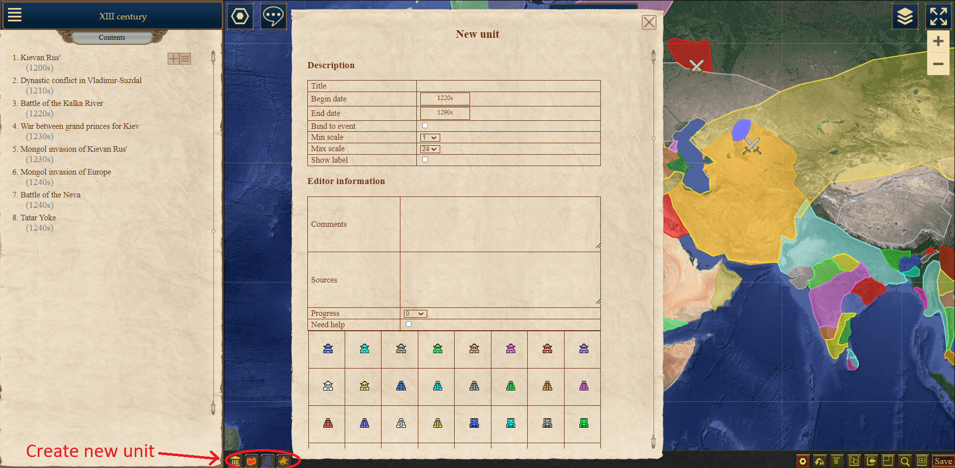
When you click on one of the object creation buttons, a window will appear where you can enter its parameters.
Common Parameters:
Parameters that are common to all types of objects:
- Name
- Time interval during which the object will be visible on the map. You need to specify the start and end dates of the object's life.
- Minimum and maximum zoom levels at which the object will be visible on the map. Can be adjusted from 1 to 24. These settings are used to prevent certain objects (e.g., small cities) from being visible at low zoom levels, to avoid cluttering the map. They will appear when the map is zoomed in to the specified level. The current zoom level is indicated on the bottom editing panel.
- Show labels. If you want to show the names of all objects, the map may become overloaded. You can hide the names of small or insignificant objects by unchecking this option. However, the names will still be displayed when hovering over the object.
For regions and lines, the following parameters are specified:
- Width: For regions - border width, for lines - line width.
- Color
- Transparency in %. 0% - fully opaque, 100% - fully transparent.
- Overlay order. If objects intersect, objects with a higher overlay order will be placed above objects with a lower order.
For static and movable units, you need to specify an icon that will represent the object on the map. You can choose an icon from a predefined list or upload your own.
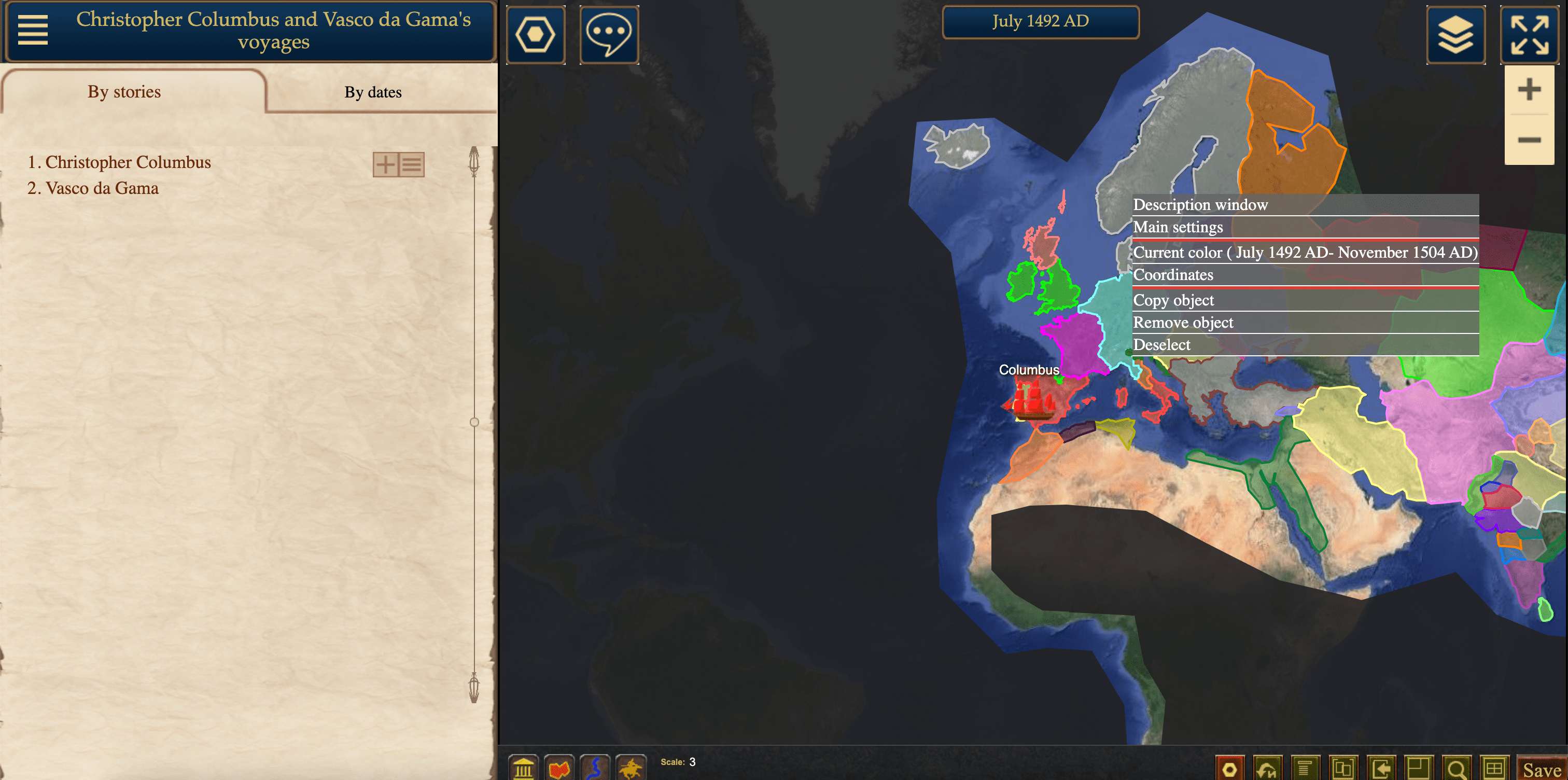
To modify the parameters of a created object, you can use the menu that opens when right-clicking on it.
Dynamic Parameters:
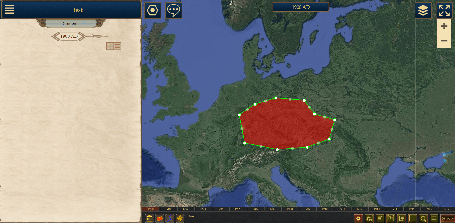
Some parameters need to change as events unfold on the map. The mechanism for working with such parameters is the same for all of them. Let me explain using the example of region borders. A region is used to denote the territory of a state, but it changes over time. Suppose we have a region with a lifespan from 1900 to 1910 on a map with a step of 1 year. In 1900, our region had certain borders.
But in 1905, it acquired different borders. In this case, we need to switch to 1905. Right-click on the region, and in the menu that appears, select "New Territory."
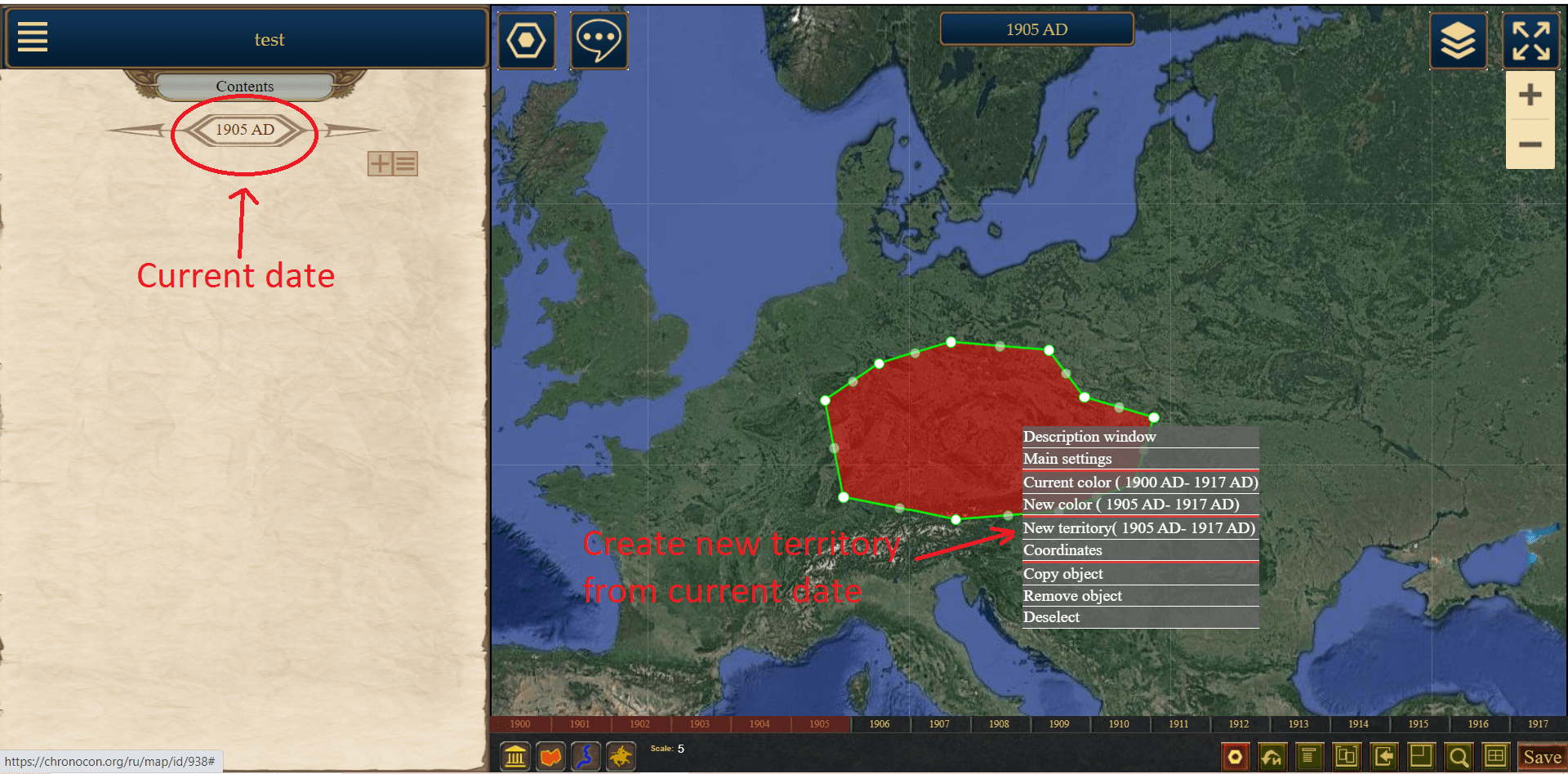
After that, we have two independent territories for this object. One is displayed from 1900 to 1904, and the other from 1905 to 1910. Now we can edit them separately. Go to 1900 and edit the first one, then go to 1905 and edit the second one.

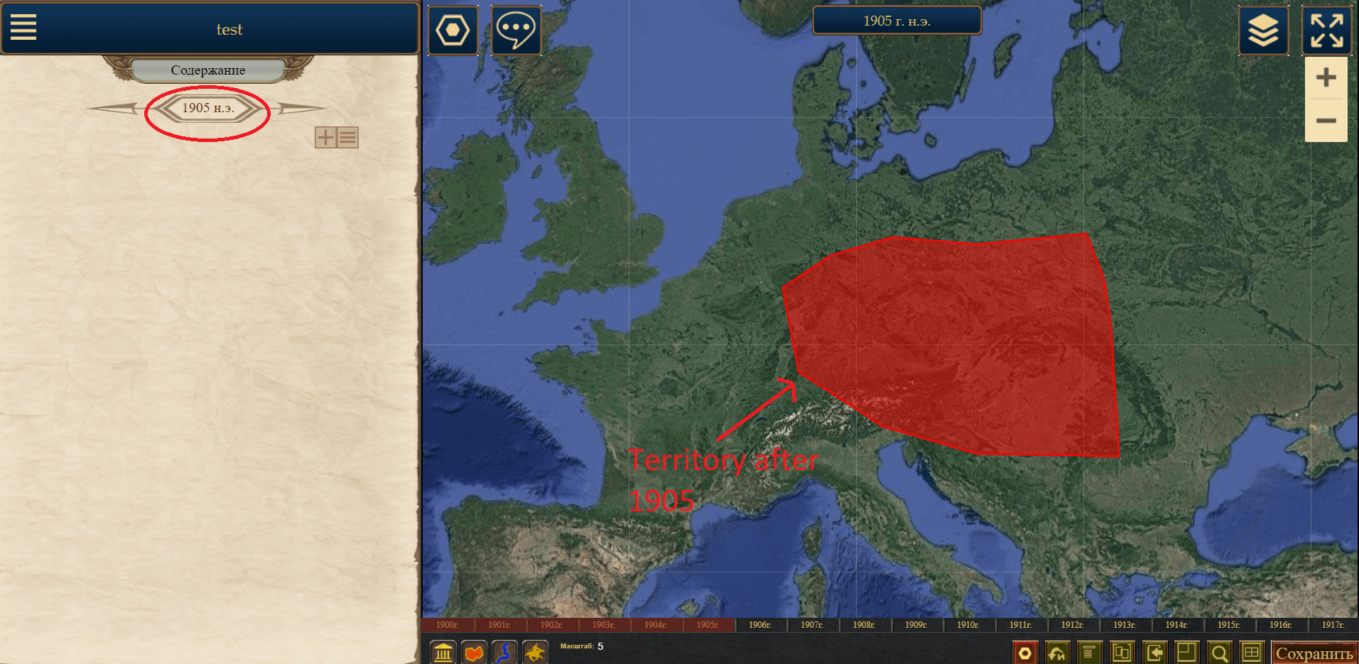
If we need to change the territory again from 1908, we need to go to 1908, click "New Territory," and we will have three territories: 1900-1904, 1905-1907, 1908-1910. You can delete each territory (except the first one) by selecting "Delete Territory" from the menu. In that case, the previous one will be displayed instead of the deleted one.
Dynamic parameters include the color of lines and regions, as well as the icon of movable and stationary units. The color is adjusted using the menu items "New Color," "Current Color," and "Delete Current Color," while the icon is managed using "New Icon," "Current Icon," and "Delete Icon."
Object Description:
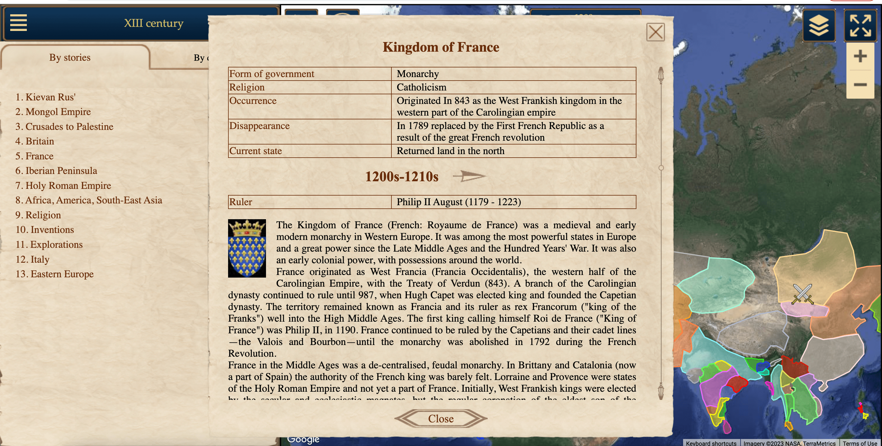
When you click on an object, a window with the object description opens. It consists of four parts:
- Table: It can contain any parameters of the object. For example, in the case of a state, it could include "population," "religion," "ruler."
- Current Table: Some fields in the table may change over time, such as "ruler." Such fields can be placed in a dynamic table. Changes are made similarly to modifying the territory of a region, as described above. To do this, use the icons "New Table," "Current Table," and "Delete Current Table" next to the "Current Table" heading.
- Description: Textual description of the object.
- Current Events: Similar to the table, the dynamic part of the description can be filled based on the current date.
Each of these fields can be edited by clicking on the pencil icon next to the heading.

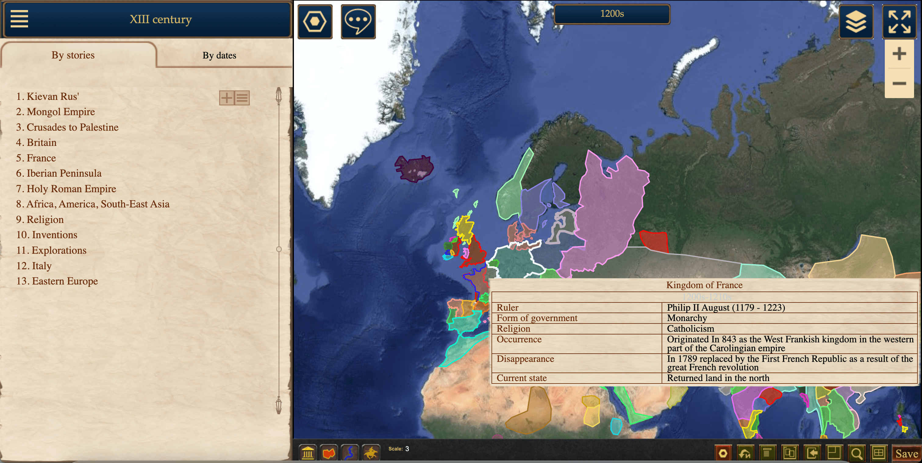
When filling in the tables with state parameters, it was sometimes necessary to copy the parameter names each time, which were the same for all objects (e.g., for states: "emergence," "disappearance," "form of government," "ruler," "dynasty," "religion," "current position"). To speed up this process, table templates were introduced. You can configure a template once and apply it on the table editing page. Templates can be edited by following the link in the editing panel. When hovering over an object on the map, the combined table will be displayed.

Service Fields:
For each object, you can fill in service fields such as "sources," "comments," "progress," and "need help." These fields are not displayed in the viewing mode; they are used for information exchange between map editors.
